 |
The boat trip in April 2009 |
|
Log book Ireland April 2009
|
|
back to the
main page |
|
|
|
|

|
Thursday 16/04/09 Portumna Castle - Garrykennedy Length of boat trip: 2.8 hours Motto of the day: Lough Derg shows us its choppy side It has rained during the night and the wind is increasing this morning. It is cloudy and the sun rare. After a dry walk through the nice town of Portumna; Port Omna; landing place of the oak tree; we set off to explore Lough Derg. This great lake is part of the southern Hill and Vale Province, a hilly landscape but part of the Central Plain. The landscape at the northern end of Lough Derg has a flattish character, although the Slieve Aughty Mountains (Map 9); Sliabh Aughty (Eachtaigh); lies in the northwest. Slieve Aughty "is named from Echtghe the Awful, the divine daughter of the god Nuada Silver-Arm. These hills were given to her by her lover, the cup-bearer of Gann and Genann, the eponymous ancestors of the Ganganoi of Ptolemy." (http://www.clarelibrary.ie/eolas/coclare/folklore/folk_tales/chapter1.htm). The border between Counties Clare and Galway runs on top the Aughtys. This is not suprising as well as the Shannon is a border between Counties also. The Slieve Aughty uplands consist of two main ridges, all in all extensive marchland with less forest cover on top. One of the highest points of the northern ridge is Cashlaundrumlahan (Casileandrumleathan ?) at 1,207 feet, around 368 m. A wind farm is located to the west of this summit. During the building of the windmills in 2003 a bogslide occured well as last year at Lough Allen. The mountain ridge continues eastwards to within three kilometres of Lough Derg. Here is Cappaghabaun a prominent summit with a height also around 370 m. Hard sandstone underlay most parts of Lough Derg. At the north end the lake is there not very deep but the depth increases, corresponding to the higher mountains, further south, to 25-30 m. In the southwest of the lake in the backround near Scarriff rises the highest point of the Aughty Mountains, Maghera, to a height of 1,314 feet; around 400 m. The southern part of Lough Derg is more impressive than the northern part with steep flanks of mountains. Slieve Bernagh; Sliabh-bearnach; gapped mountain; with 531 m and some smaller hills fringing the Lough to the southwest of Killaloe. Opposite in the east are the Arra Mountains with 461 m, composed of slate (Map 10). Some worth mentioning rivers flow into Lough Derg. First of all the River Scarriff which is navigable to the town of the same name. The second navigable river is the Woodford which reaches the lake in the northwest at Rossmore Quay. The Nenagh River which arises from the eastern flanks of the Silvermine Mountains (Map 11) in North Tipperary joins Lough Derg at Dromineer on the easter side of the lake. Youghal Bay on Lough Derg is a nice place to have a view of these mountains.
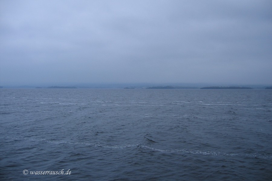
But as we start at Portumna Castle on our first day on this magnificent lake we see nothing of the mountains and only sometimes the shapes of the beautiful shores. Wind and showers accompany our trip.
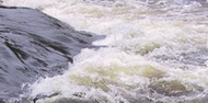
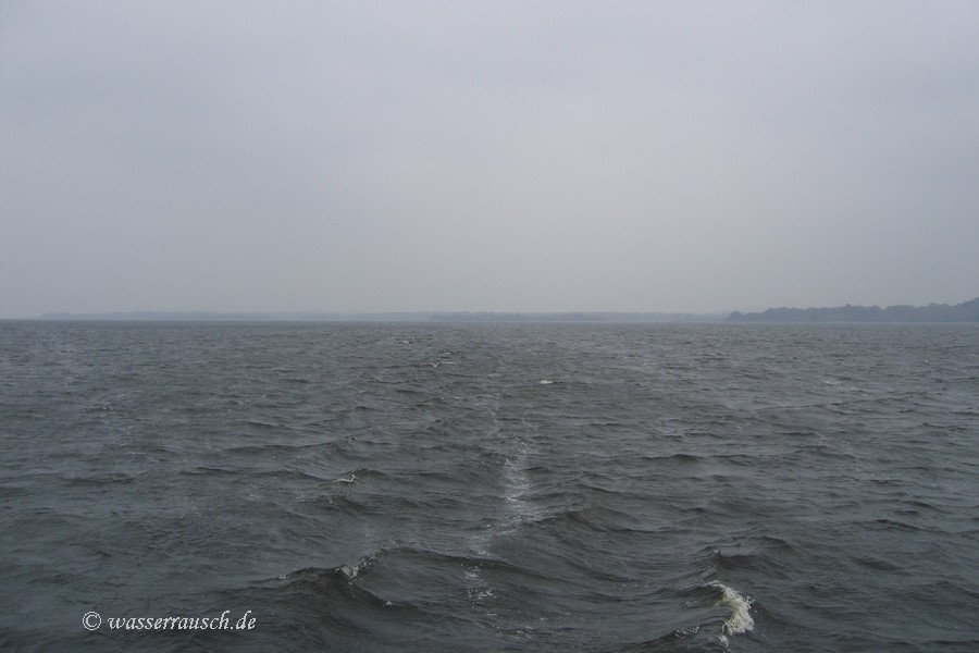
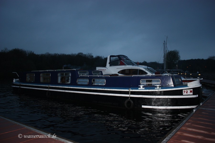
Most of the time we are sheltered from the northeasterly wind by going down the eastern shore but the wind from the side going past the offset bays make our boat roll. The more we are going further south the wind increases and crossing Youghal Bay with F5 or more from the side and the long waves from the back is an interesting foretaste what would await us at Parkers Point. So we decide to stop at Garrykennedy. The nice skipper of a canalboat is at the ready when we moor beside him against the wind but he doesn't have much to do to help and smiles. It's nice to meet a friendly skipper of the metall stuff who doesn't use GRP-boats only as fenders and especially not those of hire companies. Thanks Ronny! It's not only the great landscape but also the nice Irish people which bring joy to us. The jetty is going up and down although some tons of steel are lying beside us. The breakwater is not really the best by comparison to others we know. Some other Derghies arrive later in the evening but we don't care about them after the unfriendly behaviour of a single-handed skipper on a boat covered with a lot of plastic planes who ignores us and starts a cool whistle but he makes a fuss about the arrival of a supposedly loaded tuppaware-cruiser and bustles about on the jetty. Sometimes boaters are boring when they are not grown-up. But we have nice neighbours this night.
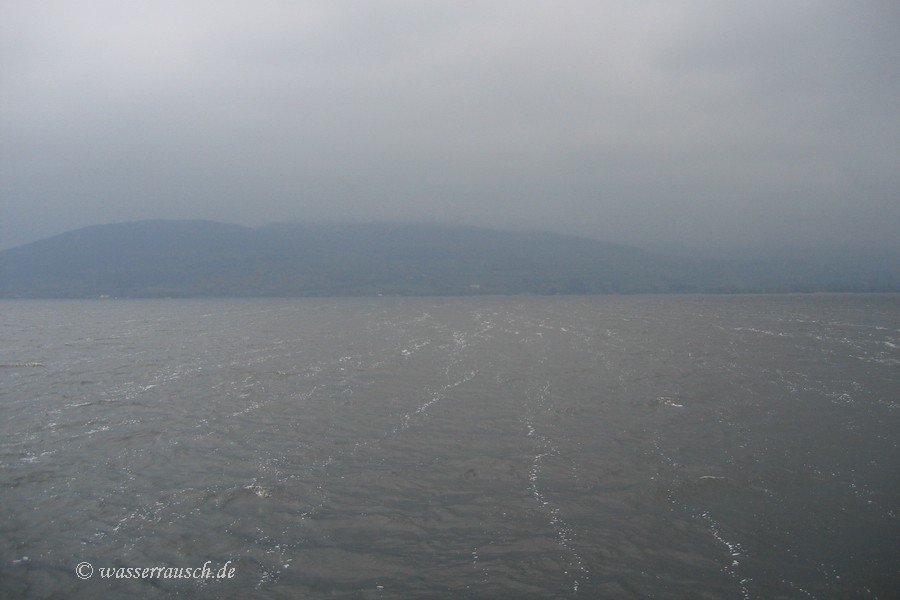
Friday 17/04/09 Garrykennedy - Killaloe Length of boat trip: 2.2 hours Motto of the day: Low drooping clouds and a visit to Ardnacrusha The morning again is cloudy and persistently drizzly. We leave early, the wind is coming from northeast like yesterday. In the lee of the Arra Mountains the water is calmer. We miss the views to the surrounding mountains but we feel them as Rolt has described it: "Though the encircling mountains were invisible we could somehow sense their presence, this opaque curtain being so much a part of them." He had a curtain of fog, we one of rain and low drooping clouds.
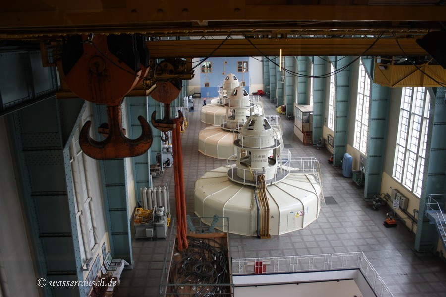
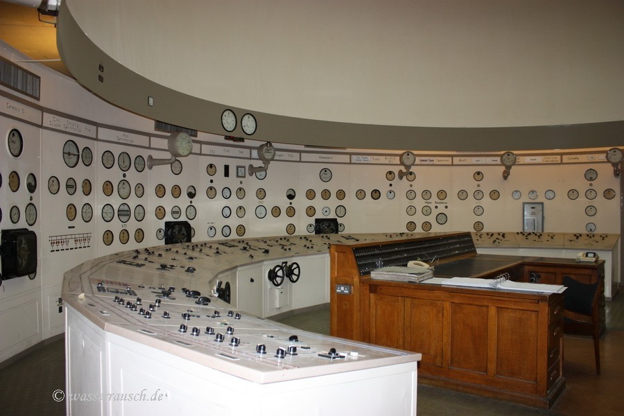
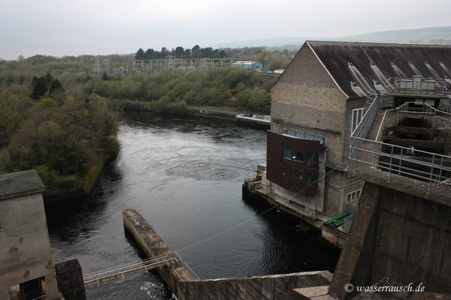
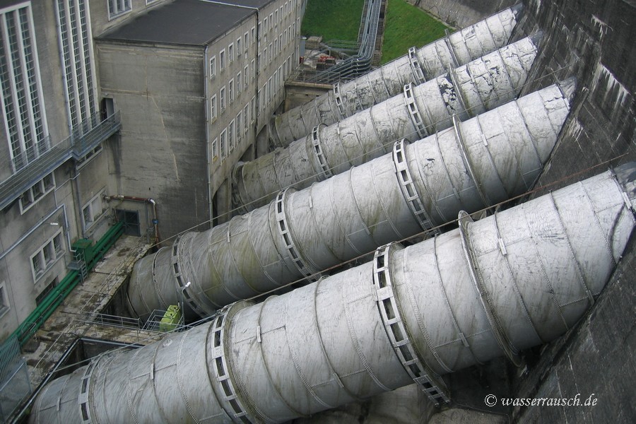
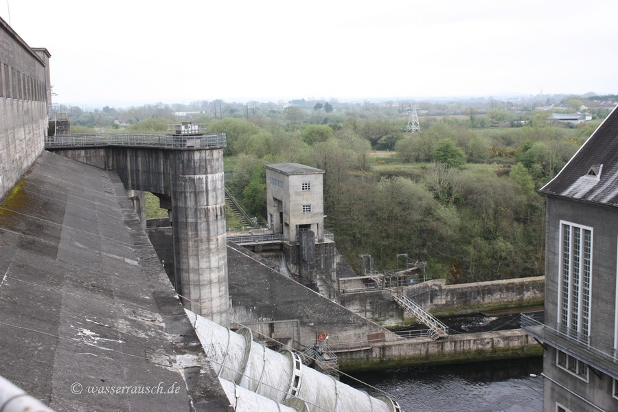
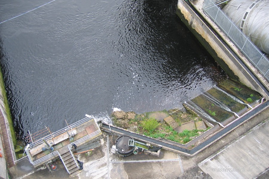
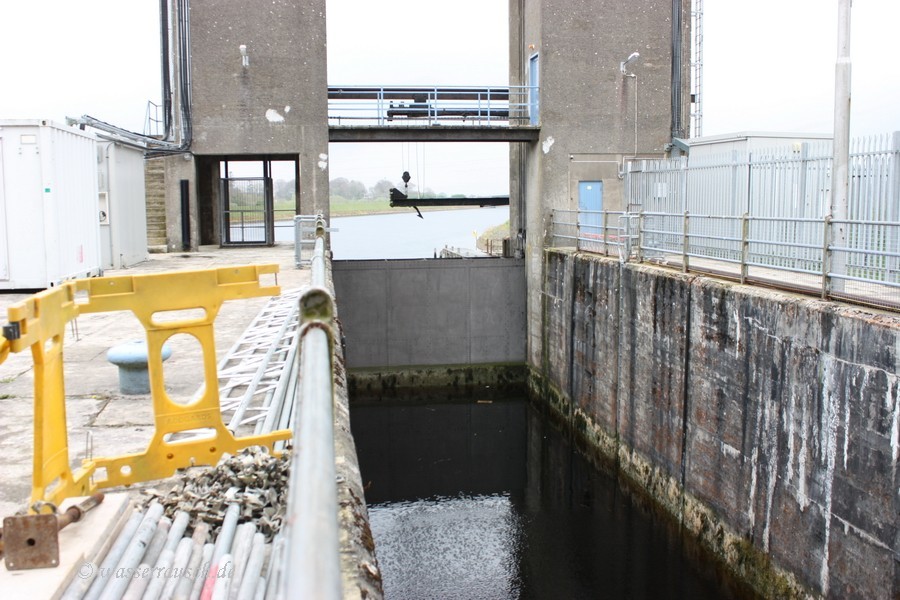
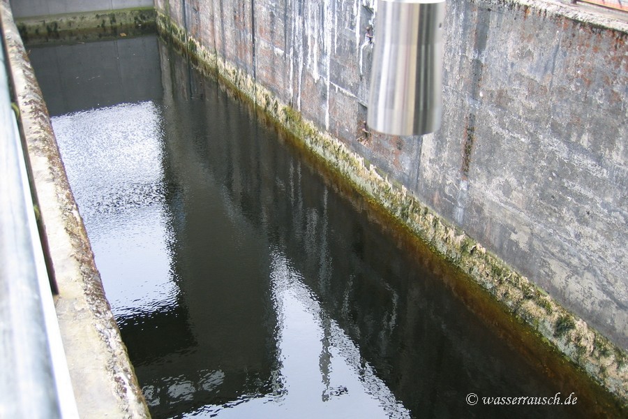
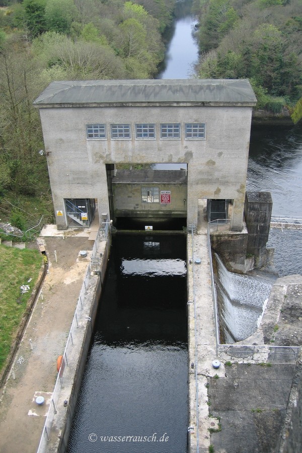
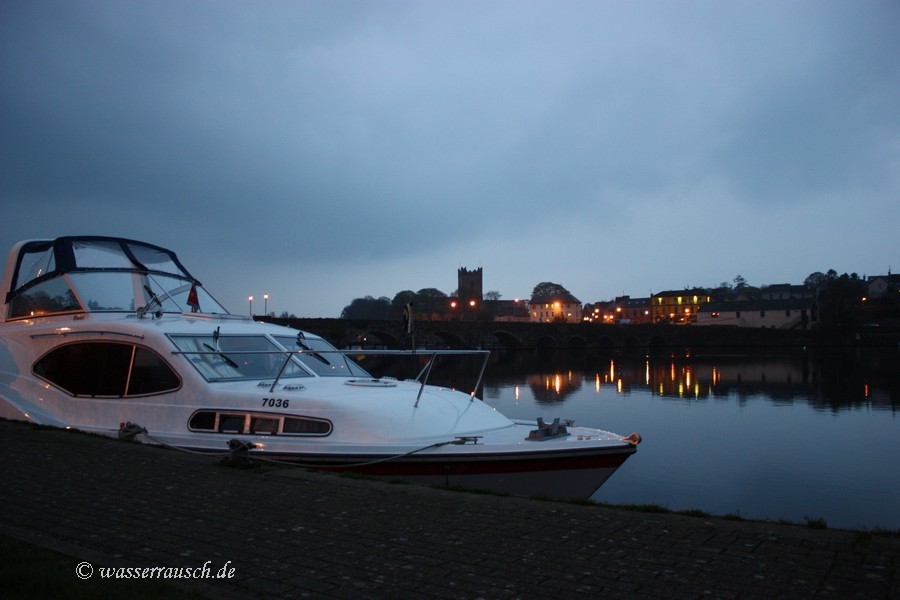
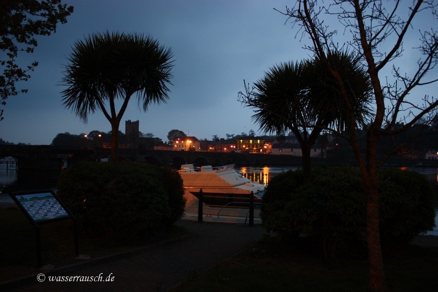
We arrive for breakfast at Killaloe. The rain stops and we meet Kevin and visit Ardnacrusha (Map 11). Gerry, the lockkeeper, gives us a guided tour of this impressive hydro power station.
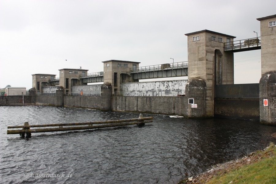
On our drive back we stop and walk to Parteen Weir where the Head Race starts. Back at Killaloe we enjoy a quiet evening. 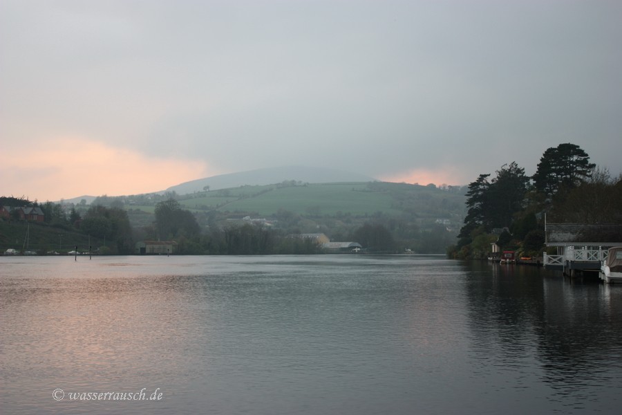
|
|
Mainpage Wasserrausch Contact Imprint
Copyright Tina und Willi Klug 2009